|
|
|
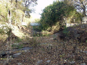
The beauty of the property has been created over the eons by water. One small creek meanders through the center of the property and a larger creek forms the northern border of the property. Both of these creeks have been responsible for shaping the property into its rolling terrain which exists today, but if the water was allowed to continue unabated, it would continue to reshape the land into something entirely different. The professional solution implemented to solve this potential problem includes erosion barriers, property wide drainage, subterranean French drainage, floodgates and ground water control,
|
|
|
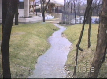
Hint of potential future problems.
The small meandering creek has
given life to many of the large natural trees which are so much a part of the beauty of the property. The
small creek empties into the Stonebriar Creek which was named by the Stonebriar Creek Estates developer many years ago. Subsequently, a multitude of residential and commercial
developments such as Stonebriar Country Club, Stonebriar Mall, Stonebriar
Park, etc. all adopted the "Stonebriar" name.
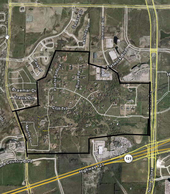
STONEBRIAR CREEK ESTATES BOUNDARIES
Originally, Stonebriar Creek Estates was created for Dallas residents to have a weekend country getaway where they could ride and raise horses. Little did the original developers dream that this subdivision would end up in the center of the thriving North Dallas Metroplex.
|
|
|
|
|
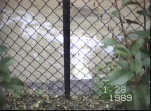
Underground storm drains enable the the small creek to have a sub surface means of emptying into Stonebriar Creek.
|
|
Floodgates
above the storm drain automatically open from
the force
of the surface water when extremely heavy rains produce more water than the storm drain
can carry.
|
|
|
|
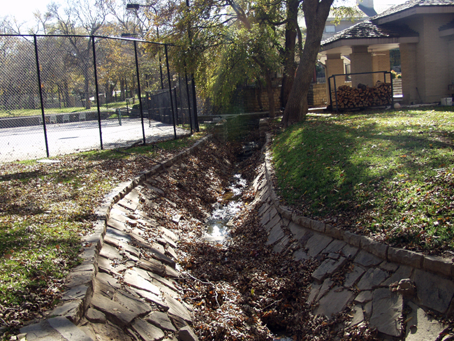
The small creek (below) now has a solid stone faced foundation at its bottom and sides. Since completion, in the early 1990 erosion has ceased to exist.
|
|
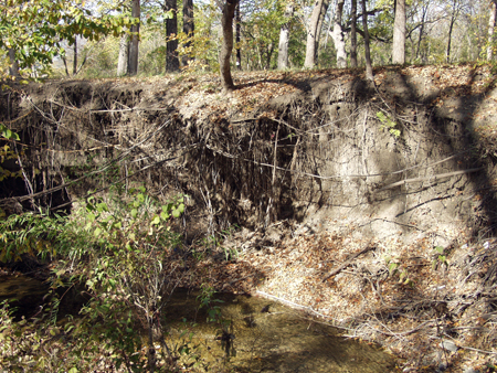
Stonebriar Creek has demonstrated its ability to change from an almost dry creek to what would better be described as a rolling river. Unless properly protected, the combined strength of the surface water and sub surface currents destroys the creek banks, the fencing along the creek, the surface soil, and 100 year old trees. The carnage is then carried away downstream. The solution, both from an aesthetic and engineering standpoint, is called a gabion structure.
|
|
|
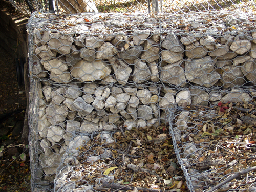
Gabion structures both absorb and repel the force of the water currents. Although railroad ties can be used for soil retention where water force is not a problem, gabion structures are a must where the power of the water is strong, particularly around the curves of the creek where centrifugal force increases the already powerful water currents.
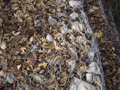
A single gabion is a wire mesh cubic box about 18 inches in each dimension. Each gabion is filled on site with rock, is wired closed and then is wired to another gabion. The gabions can be constructed to fit whatever size and shape is required. The finished structures create an erosion barrier that competes with the granite river bank sides running through the Rocky Mountains.
|
|
These photos show details of a single gabion, two gabions wired together, and and some of the gabion structures currently in place.
|
|
|
|
The finished gabion structures, shown in the video below, handle the water as needed, sometimes even as a curved wall. Railroad ties remain adequate to retain the soil where appropriate. Since construction in the early 1990s, it does not appear that even one gabion has been move or eroded. Each gabion basket remains as full of rocks today as when it was built. The structure protects itself from internal erosion. This video was taken in December, 2006.
|
|